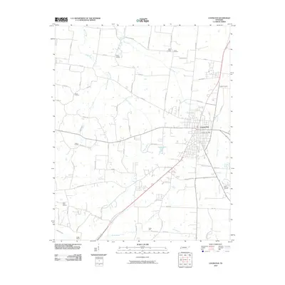
2010 Map of Covington
USGS Topo · Published 2010About this map
Covington serves as the focal point of this western Tennessee landscape, where the town's street grid expands outward from the Covington Post Office toward agricultural surroundings. The map reveals a densely recorded history through its many burial grounds, including the Mount Lebanon Cemetery, Shiloh Cemetery, and Walton Cemetery. These sites, along with smaller family or church plots like Avery Cemetery and Leighs Chapel Cemetery, offer significant points of interest for genealogical research. The drainage pattern of the region is defined by Mathis Creek and Town Creek, which meander through the terrain alongside water features like Tatlock Lake and the Indian Creek Canal. Transportation is represented by a network of rural roads such as Roughedge Rd and Millstone Mountain Rd, while Cates Airport and Jones Dam mark the modern and modified character of the Tipton County landscape.
Find a feature on this map
73 named features on this map. Tap any name to fly to it.
Don’t see what you’re looking for? This feature index may not catch every label — zoom into the map to look around manually.
Map Details
Editions of this 2010 Covington Map
This is the sole edition of this map. No revisions or reprints were ever made.
Other maps of this area

1942 · Millington
USGS Topo · 1:62,500

1954 · Mason
USGS Topo · 1:62,500

1956 · Blytheville
USGS Topo · 1:250,000

1959 · Blytheville
USGS Topo · 1:250,000

1960 · Millington
USGS Topo · 1:62,500

1961 · Rialto
USGS Topo · 1:62,500

1962 · Rialto
USGS Topo · 1:62,500

1963 · Osceola
USGS Topo · 1:62,500

1965 · Osceola
USGS Topo · 1:62,500

1965 · Brighton
USGS Topo · 1:24,000