
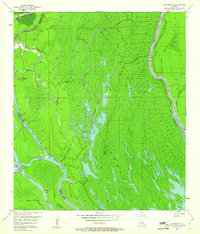
1953 Map of Cow Bayou
USGS Topo · Published 1954About this map
The Atchafalaya Floodway dominates this mid-century landscape, illustrating the complex hydraulic engineering required to manage the basin. The eastern edge is defined by the East Protection Levee, a massive earthwork designed to channel floodwaters and protect the surrounding parishes. This drainage system is woven through with an intricate network of waterways including the Grand River, Billy Little Lake, and the engineered Whisky Bay Pilot Channel. Industrial activity is evident along the Indefinite Boundary between St. Martin and Iberville Parish, where several Gas Wells and an Oil Well are located near Bristow Bayou. This survey reveals the transition between natural wetlands and the managed flow of the Atchafalaya River, featuring landforms like Cow Island and the Spoil Bank that resulted from dredging operations.
Find a feature on this map
27 named features on this map. Tap any name to fly to it.
Don’t see what you’re looking for? This feature index may not catch every label — zoom into the map to look around manually.
Map Details
Editions of this 1953 Cow Bayou Map
2 editions found
Other maps of this area

1935 · Osca Bayou
USGS Topo · 1:62,500

1935 · Chicot Lake
USGS Topo · 1:62,500

1940 · Grosse Tete
USGS Topo · 1:62,500

1941 · Loreauville
USGS Topo · 1:62,500

1953 · Pigeon Bay
USGS Topo · 1:24,000

1953 · Maringouin
USGS Topo · 1:24,000

1953 · Grosse Tete SW
USGS Topo · 1:24,000

1954 · Chicot Lake
USGS Topo · 1:62,500

1954 · Loreauville
USGS Topo · 1:62,500

1954 · Grosse Tete
USGS Topo · 1:24,000