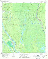
1969 Map of Cow Bayou
USGS Topo · Published 1982About this map
The Atchafalaya Basin Floodway dominates this landscape, showing the complex hydrologic management of the late 1960s. This territory, split by the Iberville Parish St Martin Parish line, is defined by an intricate network of waterways including Bayou des Glaises, Bayou Maringouin, and Straight Bayou. The map illustrates a transitional period in the basin's industrial development, with established sites like the Bayou des Glaises Oil and Gas Field and the Klondike Field interspersed among the cypress-tupelo bottomlands.
Find a feature on this map
35 named features on this map. Tap any name to fly to it.
Don’t see what you’re looking for? This feature index may not catch every label — zoom into the map to look around manually.
Map Details
Editions of this 1969 Cow Bayou Map
2 editions found
Other maps of this area

1935 · Osca Bayou
USGS Topo · 1:62,500

1935 · Chicot Lake
USGS Topo · 1:62,500

1940 · Grosse Tete
USGS Topo · 1:62,500

1941 · Loreauville
USGS Topo · 1:62,500

1953 · Cow Bayou
USGS Topo · 1:24,000

1953 · Pigeon Bay
USGS Topo · 1:24,000

1953 · Maringouin
USGS Topo · 1:24,000

1953 · Grosse Tete SW
USGS Topo · 1:24,000

1954 · Chicot Lake
USGS Topo · 1:62,500

1954 · Loreauville
USGS Topo · 1:62,500