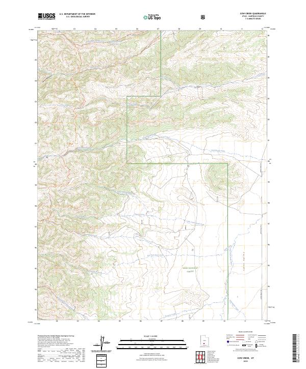
2023 Map of Cow Creek
USGS Topo · Published 2023About this map
Dixie National Forest defines the rugged geography of this Garfield County quadrangle, where high-altitude drainages form a complex network of creeks and springs. The northern section is anchored by Mountain Spring Reservoir and the Mountain Spring Fork, while the eastern edge transitions into the wide expanse of Johns Valley. The landscape is a vital watershed for the East Fork Sevier River, with numerous named watercourses like Cow Creek and Cherry Creek carving through the terrain.
Find a feature on this map
24 named features on this map. Tap any name to fly to it.
Don’t see what you’re looking for? This feature index may not catch every label — zoom into the map to look around manually.
Map Details
Editions of this 2023 Cow Creek Map
This is the sole edition of this map. No revisions or reprints were ever made.
Other maps of this area

1885 · Beaver
USGS Topo · 1:250,000

1885 · Fish Lake
USGS Topo · 1:250,000

1886 · Kanab
USGS Topo · 1:250,000

1886 · Escalante
USGS Topo · 1:250,000

1896 · Fish Lake
USGS Topo · 1:250,000

1953 · Richfield
USGS Topo · 1:250,000

1953 · Cedar City
USGS Topo · 1:250,000

1956 · Escalante
USGS Topo · 1:250,000

1956 · Salina
USGS Topo · 1:250,000

1958 · Richfield
USGS Topo · 1:250,000