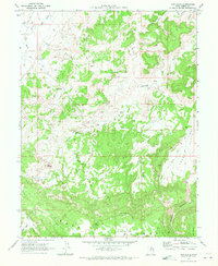
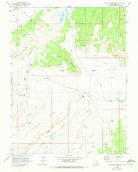
1969 Map of Cow Flats
USGS Topo · Published 1972About this map
Cleveland Lloyd Dinosaur Quarry stands as the centerpiece of this Emery County landscape, accompanied by its dedicated Visitor Center during the late 1960s. The terrain is defined by a network of drainage systems and high points, including the prominent southern rise of Cedar Mountain and the uniquely named The Nippte. Water management is central to this arid region, evidenced by the scattered network of cattle-country infrastructure such as Cow Flat Reservoir, Dugway Reservoir, and Pilling Pond. Long-standing water sources like Wimmer Spring and Staker Spring appear alongside broad, flat landforms like Lucky Flats and Wimmer Flat. The map documents a rugged interior accessible primarily by a web of Jeep Trails and unnamed trails, tracing the paths through Humbug Canyon and around the distinct Huff Bench.
Find a feature on this map
28 named features on this map. Tap any name to fly to it.
Don’t see what you’re looking for? This feature index may not catch every label — zoom into the map to look around manually.
Map Details
Editions of this 1969 Cow Flats Map
2 editions found
Other maps of this area

1886 · Price River
USGS Topo · 1:250,000

1896 · Price River
USGS Topo · 1:250,000

1956 · Price
USGS Topo · 1:250,000

1960 · Price
USGS Topo · 1:250,000

1962 · Price
USGS Topo · 1:250,000

1969 · Olsen Reservoir
USGS Topo · 1:24,000
1969 · Chimney Rock
USGS Topo · 1:24,000
1969 · Bob Hill Knoll
USGS Topo · 1:24,000
1969 · Buckhorn Reservoir
USGS Topo · 1:24,000

1969 · Elmo
USGS Topo · 1:24,000