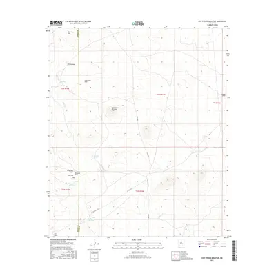
2017 Map of Cow Springs Mountain
USGS Topo · Published 2017About this map
The Butterfield Trl cuts across this high desert landscape, marking the historic path of the 19th-century overland mail route through the borderlands of Grant and Luna counties. This 2017 survey details a terrain defined by intermittent drainages and isolated peaks, centered on the distinct prominence of Cow Springs Mountain. To the north, the elevation rises toward Bear Grass Hill, while the surrounding flats are carved by seasonal watercourses like Cow Springs Draw and West Antelope Draw.
Find a feature on this map
24 named features on this map. Tap any name to fly to it.
Don’t see what you’re looking for? This feature index may not catch every label — zoom into the map to look around manually.
Map Details
Editions of this 2017 Cow Springs Mountain Map
This is the sole edition of this map. No revisions or reprints were ever made.
Other maps of this area

1909 · Silver City
USGS Topo · 1:125,000

1947 · Faywood Station
USGS Topo · 1:24,000

1949 · Whitewater
USGS Topo · 1:24,000

1949 · Faywood Station
USGS Topo · 1:24,000

1950 · White Signal
USGS Topo · 1:24,000

1951 · White Signal
USGS Topo · 1:24,000

1954 · Silver City
USGS Topo · 1:250,000

1958 · Silver City
USGS Topo · 1:250,000

1962 · Silver City
USGS Topo · 1:250,000
1963 · Antelope Hill
USGS Topo · 1:24,000