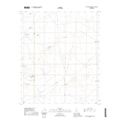
2020 Map of Cow Springs Mountain
USGS Topo · Published 2020About this map
Cow Springs Mtn rises above a desert landscape defined by ephemeral waterways and historic transportation routes along the border of Grant and Luna Counties. This high-desert terrain is bisected by the Butterfield Trl, a historic corridor that provided passage through the basin and range province. The map reveals an intricate network of drainage systems, including Cow Springs Draw, Walnut Cr, and West Antelope Draw, which characterize the area's hydrology. Water management for cattle and local use is evidenced by several named reservoirs such as Rattlesnake Tank, Hogback Tank, and Thorne Hay Draw Tank. The topography is further punctuated by distinctive landmarks like Bear Grass Hill and the deep cuts of White Rock Canyon and Oak Canyon, reflecting the arid geography of southwestern New Mexico.
Find a feature on this map
23 named features on this map. Tap any name to fly to it.
Don’t see what you’re looking for? This feature index may not catch every label — zoom into the map to look around manually.
Map Details
Editions of this 2020 Cow Springs Mountain Map
This is the sole edition of this map. No revisions or reprints were ever made.
Other maps of this area

1909 · Silver City
USGS Topo · 1:125,000

1947 · Faywood Station
USGS Topo · 1:24,000

1949 · Whitewater
USGS Topo · 1:24,000

1949 · Faywood Station
USGS Topo · 1:24,000

1950 · White Signal
USGS Topo · 1:24,000

1951 · White Signal
USGS Topo · 1:24,000

1954 · Silver City
USGS Topo · 1:250,000

1958 · Silver City
USGS Topo · 1:250,000

1962 · Silver City
USGS Topo · 1:250,000
1963 · Antelope Hill
USGS Topo · 1:24,000