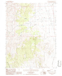
1986 Map of Cowboy Rest Creek
USGS Topo · Published 1986About this map
Toiyabe Range topography dominates the western portion of this 1980s survey, where steep slopes descend into the expansive flats of Grass Valley. The landscape is characterized by its high-altitude water sources, with numerous Springs and named drainages like Rosebush Creek and the North Fork Skull Creek carving through the mountain faces. Settlement is sparse and focused on ranching and resource extraction, centered around the Cowboy Rest locality. This area reflects the mid-century survival of traditional Great Basin land use, where isolated structures like a Corral and a lone Prospect indicate the intersection of cattle management and small-scale mineral exploration. The map provides a clear look at the transitional terrain where the mountain foothills meet the valley floor, showing the network of unimproved roads that connected these remote Nevada outposts.
Find a feature on this map
11 named features on this map. Tap any name to fly to it.
Don’t see what you’re looking for? This feature index may not catch every label — zoom into the map to look around manually.
Map Details
Editions of this 1986 Cowboy Rest Creek Map
This is the sole edition of this map. No revisions or reprints were ever made.
Other maps of this area

1926 · Roberts Mountains
USGS Topo · 1:250,000

1929 · Roberts Mountains
USGS Topo · 1:250,000

1955 · Millett
USGS Topo · 1:250,000

1956 · Mount Callaghan
USGS Topo · 1:62,500

1956 · Walti Hot Springs
USGS Topo · 1:62,500

1956 · Hall Creek
USGS Topo · 1:62,500

1956 · Ackerman Canyon
USGS Topo · 1:62,500

1959 · Millett
USGS Topo · 1:250,000

1979 · Simpson Park Mtns
USGS Topo · 1:100,000
1986 · Hall Creek North
USGS Topo · 1:24,000