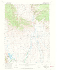
1956 Map of Cowdrey
USGS Topo · Published 1969About this map
The North Platte River and its major tributaries, the Michigan River and Canadian River, carve through this high basin landscape at the northern edge of Jackson County. In the mid-1950s, the area remained a complex network of ranching and early energy extraction. Small settlements like Cowdrey and Northgate served as hubs for the surrounding cattle operations, including the Wattenberg Ranch and Simmons Ranch. The landscape is heavily defined by its water management, shown through an extensive system of man-made irrigation such as the Seneca Ditch and Pioneer Ditch.
Find a feature on this map
72 named features on this map. Tap any name to fly to it.
Don’t see what you’re looking for? This feature index may not catch every label — zoom into the map to look around manually.
Map Details
Editions of this 1956 Cowdrey Map
2 editions found
Other maps of this area

1906 · Medicine Bow
USGS Topo · 1:125,000

1908 · Medicine Bow
USGS Topo · 1:125,000

1911 · Hahns Peak
USGS Topo · 1:125,000

1913 · Hahns Peak
USGS Topo · 1:125,000

1939 · Saratoga
USGS Topo · 1:125,000

1950 · Northgate
USGS Topo · 1:24,000

1950 · Kings Canyon
USGS Topo · 1:24,000

1952 · Northgate
USGS Topo · 1:24,000

1952 · Kings Canyon
USGS Topo · 1:24,000

1954 · Rawlins
USGS Topo · 1:250,000