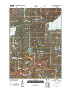
2011 Map of Cowhorn Mountain
USGS Topo · Published 2011About this map
Cowhorn Mountain and Sawtooth Mountain dominate this section of the Oregon Cascades, anchoring a high-elevation landscape defined by glacial lakes and headwater streams. The presence of Whitefish Horse Camp, Windy Group Camp, and Spring Forest Camp near Carter Lake suggests a long-established recreational infrastructure designed for back-country access. Water resources are plentiful throughout the quadrangle, with Summit Lake and Timpanogas Lake joined by smaller, remote basins like Sow Bug Lake and the Windy Lakes.
Find a feature on this map
45 named features on this map. Tap any name to fly to it.
Don’t see what you’re looking for? This feature index may not catch every label — zoom into the map to look around manually.
Map Details
Editions of this 2011 Cowhorn Mountain Map
This is the sole edition of this map. No revisions or reprints were ever made.
Other maps of this area

1917 · Diamond Lake
USGS Topo · 1:125,000

1925 · Waldo Lake
USGS Topo · 1:125,000

1930 · Maiden Peak
USGS Topo · 1:125,000

1934 · Maiden Peak
USGS Topo · 1:125,000

1935 · Chemult
USGS Topo · 1:96,000

1941 · Chemult
USGS Topo · 1:125,000

1955 · Crescent
USGS Topo · 1:250,000

1956 · Waldo Lake
USGS Topo · 1:62,500

1956 · Summit Lake
USGS Topo · 1:62,500

1957 · Crescent
USGS Topo · 1:250,000