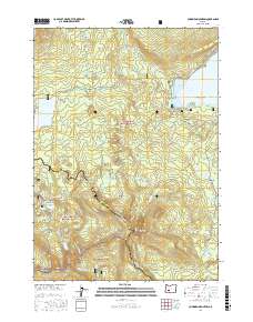
2017 Map of Cowhorn Mountain
USGS Topo · Published 2017About this map
Cowhorn Mountain stands as the central peak in this high-altitude landscape where the boundaries of the Deschutes National Forest, Willamette National Forest, and Umpqua National Forest converge. This 2017 study illustrates a complex hydrological network within the Cascade Range, featuring numerous alpine basins such as Windy Lakes, Timpanogas Lake, and Indigo Lake. The area serves as a significant recreational and transit corridor, highlighted by the Pacific Crest National Scenic Trail as it winds through Windy Pass. To the north, the terrain transitions toward the shores of Crescent Lake, including Tranquil Cove and Tandy Bay, while the Calapooya Mountains define the southwestern reaches. The map documents a dense network of forest service routes, such as the Metolius-Windigo trail and Summit Lake Run, which connect isolated features like Bingham Meadow and Crater Butte.
Find a feature on this map
72 named features on this map. Tap any name to fly to it.
Don’t see what you’re looking for? This feature index may not catch every label — zoom into the map to look around manually.
Map Details
Editions of this 2017 Cowhorn Mountain Map
This is the sole edition of this map. No revisions or reprints were ever made.
Other maps of this area

1917 · Diamond Lake
USGS Topo · 1:125,000

1925 · Waldo Lake
USGS Topo · 1:125,000

1930 · Maiden Peak
USGS Topo · 1:125,000

1934 · Maiden Peak
USGS Topo · 1:125,000

1935 · Chemult
USGS Topo · 1:96,000

1941 · Chemult
USGS Topo · 1:125,000

1955 · Crescent
USGS Topo · 1:250,000

1956 · Waldo Lake
USGS Topo · 1:62,500

1956 · Summit Lake
USGS Topo · 1:62,500

1957 · Crescent
USGS Topo · 1:250,000