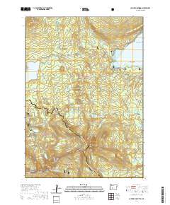
2020 Map of Cowhorn Mountain
USGS Topo · Published 2020About this map
Cowhorn Mountain stands as a central peak at the intersection of the Cascade Range and the Calapooya Mountains, where the borders of three national forests converge. The landscape is defined by its complex drainage and glaciated basins, feeding a dense network of high-elevation water bodies including Indigo Lake, Summit Lake, and the western reaches of Crescent Lake. These alpine lakes are connected by a historical network of paths, most notably the Pacific Crest National Scenic Trail as it traverses the High Divide and Windy Pass. The presence of numerous seasonal trails like Summit Lake Run and the Metolius-Windigo loop highlights the area's role as a primary corridor for wilderness travel. Geographic markers such as Bingham Meadow and Crater Butte provide distinct landmarks for those tracing the traditional boundary lines between the Willamette National Forest, Deschutes National Forest, and Umpqua National Forest.
Find a feature on this map
65 named features on this map. Tap any name to fly to it.
Don’t see what you’re looking for? This feature index may not catch every label — zoom into the map to look around manually.
Map Details
Editions of this 2020 Cowhorn Mountain Map
This is the sole edition of this map. No revisions or reprints were ever made.
Other maps of this area

1917 · Diamond Lake
USGS Topo · 1:125,000

1925 · Waldo Lake
USGS Topo · 1:125,000

1930 · Maiden Peak
USGS Topo · 1:125,000

1934 · Maiden Peak
USGS Topo · 1:125,000

1935 · Chemult
USGS Topo · 1:96,000

1941 · Chemult
USGS Topo · 1:125,000

1955 · Crescent
USGS Topo · 1:250,000

1956 · Waldo Lake
USGS Topo · 1:62,500

1956 · Summit Lake
USGS Topo · 1:62,500

1957 · Crescent
USGS Topo · 1:250,000