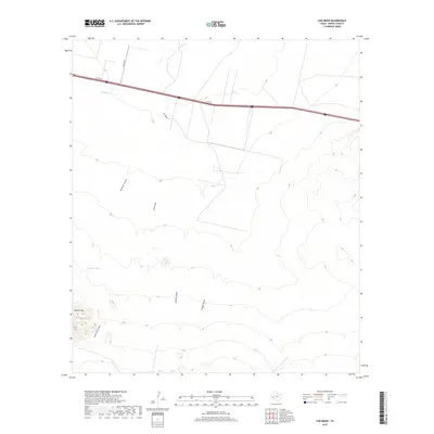
2019 Map of Cox Draw
USGS Topo · Published 2019About this map
The arid drainage systems of Cox Draw and Paloma Draw define this West Texas landscape in Reeves County, where seasonal watercourses carve through the high desert floor. The topography is dominated by the Elkins Hills to the southwest, a complex of rising ground that feeds the North Elkins Draw and Elkins Draw. This modern survey illustrates the persistent importance of limited water sources in the Trans-Pecos, specifically noted at the Gobble Hole located near the center of the quadrangle.
Find a feature on this map
11 named features on this map. Tap any name to fly to it.
Don’t see what you’re looking for? This feature index may not catch every label — zoom into the map to look around manually.
Map Details
Editions of this 2019 Cox Draw Map
This is the sole edition of this map. No revisions or reprints were ever made.
Other maps of this area

1894 · Fort Davis
USGS Topo · 1:125,000

1897 · Fort Davis
USGS Topo · 1:125,000

1921 · Toyah
USGS Topo · 1:125,000

1929 · Hovey
USGS Topo · 1:125,000

1931 · Barstow
USGS Topo · 1:125,000

1954 · Pecos
USGS Topo · 1:250,000

1954 · Fort Stockton
USGS Topo · 1:250,000

1955 · Saragosa
USGS Topo · 1:62,500

1957 · Pecos
USGS Topo · 1:250,000

1958 · Fort Stockton
USGS Topo · 1:250,000