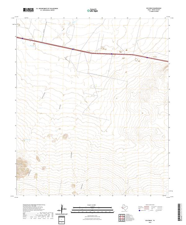
2022 Map of Cox Draw
USGS Topo · Published 2022About this map
Elkins Hills rise above a landscape defined by an intricate system of ephemeral watercourses in this portion of Reeves County. The terrain is marked by numerous draws, including Cox Draw, Paloma Draw, and Elkins Draw, which channel runoff across the arid Trans-Pecos region. Transport and access are dictated by a primary corridor following the I10 Svc Rd, while Mission Rd provides a north-south connection toward the upper reaches of Sandia Cr. The presence of Gobble Hole suggests a localized catchment or watering point of significance in an otherwise dry environment. These features represent the natural drainage patterns and the infrastructure supporting ranching and transit in modern West Texas.
Find a feature on this map
11 named features on this map. Tap any name to fly to it.
Don’t see what you’re looking for? This feature index may not catch every label — zoom into the map to look around manually.
Map Details
Editions of this 2022 Cox Draw Map
This is the sole edition of this map. No revisions or reprints were ever made.
Other maps of this area

1894 · Fort Davis
USGS Topo · 1:125,000

1897 · Fort Davis
USGS Topo · 1:125,000

1921 · Toyah
USGS Topo · 1:125,000

1929 · Hovey
USGS Topo · 1:125,000

1931 · Barstow
USGS Topo · 1:125,000

1954 · Pecos
USGS Topo · 1:250,000

1954 · Fort Stockton
USGS Topo · 1:250,000

1955 · Saragosa
USGS Topo · 1:62,500

1957 · Pecos
USGS Topo · 1:250,000

1958 · Fort Stockton
USGS Topo · 1:250,000