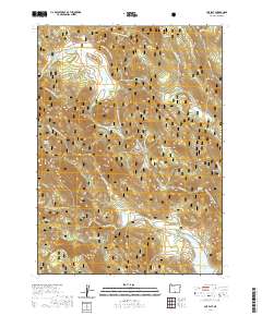
2020 Map of Cox Flat
USGS Topo · Published 2020About this map
Fremont National Forest defines the landscape of this Lake County region, where the high-elevation terrain is marked by an extensive network of drainage creeks and isolated springs. The hydrology of the area is centered on Cottonwood Reservoir in the southeast, fed by Helphenstine Cr and Cottonwood Creek. The northern portion of the map is dominated by the namesake Cox Flat, a significant level area amidst the rising contours. Numerous named water sources such as Mammoth Spring, Snake Spring, and Boggs Spring indicate the critical importance of reliable water in this forested environment. A complex system of forest development roads, including Natl Forest Develop Road 3758 Rd, provides access across the townships. The presence of Paradise Lake and various logging roads suggests a landscape managed for both timber production and natural resource conservation during the early 21st century.
Find a feature on this map
39 named features on this map. Tap any name to fly to it.
Don’t see what you’re looking for? This feature index may not catch every label — zoom into the map to look around manually.
Map Details
Editions of this 2020 Cox Flat Map
This is the sole edition of this map. No revisions or reprints were ever made.
Other maps of this area

1955 · Klamath Falls
USGS Topo · 1:250,000

1958 · Klamath Falls
USGS Topo · 1:250,000

1964 · Drews Reservoir
USGS Topo · 1:24,000

1964 · Cox Flat
USGS Topo · 1:24,000

1964 · Lakeview NW
USGS Topo · 1:24,000

1964 · Coleman Point
USGS Topo · 1:24,000

1964 · Cougar Peak
USGS Topo · 1:24,000

1964 · Shoestring Butte
USGS Topo · 1:24,000

1964 · Drews Gap
USGS Topo · 1:24,000

1964 · Clover Flat
USGS Topo · 1:24,000