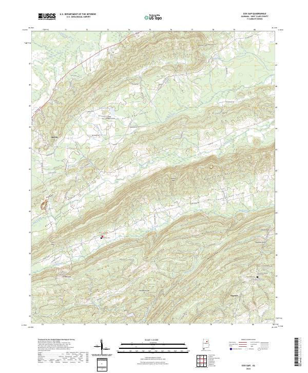
2024 Map of Cox Gap
USGS Topo · Published 2024About this map
Slash Ham Valley and the surrounding ridges of St. Clair County define this 2024 landscape, where the settlements of Ashville and Ragland sit at opposite ends of a complex network of mountain gaps and creek valleys. The terrain is marked by the recurring parallel ridges of the Canoe Creek Mountains, the Beaver Creek Mountains, and the Shoal Creek Mountains, which channel waterways like Beaver Creek and Shoal Creek through narrow corridors. Local history and genealogy interest is anchored by sites like Bethany Cem near Cox Gap and the Macedonia Baptist Church Cem on the eastern slopes. The map also traces modern recreation and agricultural spaces, from Dugger's Field and Baswell Lake in the north to Borders Lake in the south, illustrating how residential clusters have expanded along Co Rd 24 and Greensport Rd between these steep Appalachian ridges.
Find a feature on this map
76 named features on this map. Tap any name to fly to it.
Don’t see what you’re looking for? This feature index may not catch every label — zoom into the map to look around manually.
Map Details
Editions of this 2024 Cox Gap Map
This is the sole edition of this map. No revisions or reprints were ever made.
Other maps of this area

1889 · Springville
USGS Topo · 1:125,000

1892 · Springville
USGS Topo · 1:125,000

1947 · Cox Gap
USGS Topo · 1:24,000

1947 · Dunaway Mountain
USGS Topo · 1:24,000

1947 · Ragland
USGS Topo · 1:62,500

1947 · Ragland
USGS Topo · 1:24,000

1947 · Francis Mill
USGS Topo · 1:24,000

1947 · Steele
USGS Topo · 1:24,000

1947 · Steele
USGS Topo · 1:62,500
1949 · Ohatchee
USGS Topo · 1:24,000