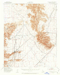
1943 Map of Coxcomb Mountains
USGS Topo · Published 1962About this map
The Coxcomb Mountains dominate this 1940s landscape, which documents a critical era of desert infrastructure development during the early war years. A significant portion of the sheet is occupied by the eastern reaches of Joshua Tree National Monument, bordering the vast Pinto Basin. The terrain is defined by the massive engineering of the Colorado River Aqueduct, which cuts across the arid floor of the Chuckwalla Valley and the southern slopes of the Eagle Mountains.
Find a feature on this map
9 named features on this map. Tap any name to fly to it.
Don’t see what you’re looking for? This feature index may not catch every label — zoom into the map to look around manually.
Map Details
Editions of this 1943 Coxcomb Mountains Map
2 editions found
Other maps of this area

1940 · Canyon Spring
USGS Topo · 1:62,500

1942 · Amboy
USGS Topo · 1:250,000

1943 · Amboy
USGS Topo · 1:250,000

1943 · Cadiz Valley
USGS Topo · 1:62,500

1943 · Iron Mountains
USGS Topo · 1:62,500

1943 · Canyon Spring
USGS Topo · 1:62,500

1943 · Coxcomb Mountains
USGS Topo · 1:62,500

1944 · Eagle Tank
USGS Topo · 1:62,500

1944 · Chuckwalla Mountains
USGS Topo · 1:62,500

1944 · Coxcomb Mountains
USGS Topo · 1:62,500