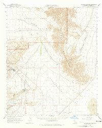
1963 Map of Coxcomb Mountains
USGS Topo · Published 1965About this map
Eagle Mountain Mine dominates the western desert landscape, where industrial infrastructure meets the protected wilderness of Joshua Tree National Monument. This 1963 field-checked survey reveals the complex engineering required to support human presence and industry in the arid Chuckwalla Valley, most notably the massive Colorado River Aqueduct snaking across the basin through a series of Siphons. The settlement of Eagle Mountain is shown with its supporting facilities, including a Landing Strip, Sewage Disposal, and the specialized Eagle Mountain Railroad used for hauling ore. Natural drainage patterns like Pinto Wash and Big Wash contrast with man-made features like the Tailings Pond and various Gravel Pits, illustrating the era's intensive resource extraction and water management efforts in the eastern Eagle Mountains.
Find a feature on this map
40 named features on this map. Tap any name to fly to it.
Don’t see what you’re looking for? This feature index may not catch every label — zoom into the map to look around manually.
Map Details
Editions of this 1963 Coxcomb Mountains Map
2 editions found
Other maps of this area

1940 · Canyon Spring
USGS Topo · 1:62,500

1942 · Amboy
USGS Topo · 1:250,000

1943 · Amboy
USGS Topo · 1:250,000

1943 · Cadiz Valley
USGS Topo · 1:62,500

1943 · Iron Mountains
USGS Topo · 1:62,500

1943 · Canyon Spring
USGS Topo · 1:62,500

1943 · Coxcomb Mountains
USGS Topo · 1:62,500

1944 · Eagle Tank
USGS Topo · 1:62,500

1944 · Chuckwalla Mountains
USGS Topo · 1:62,500

1944 · Coxcomb Mountains
USGS Topo · 1:62,500