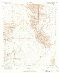
1963 Map of Coxcomb Mountains
USGS Topo · Published 1972About this map
Industrial infrastructure and protected desert landscapes intersect in this 1963 survey of Riverside County. The Eagle Mountain Mine dominates the western edge, showing a complex of Drill Holes, gravel pits, and a Tailings Pond that supported the extraction of iron ore. The specialized Eagle Mountain Mine Railroad is traced as it exits the mining site toward the south, providing a critical transport link for the remote facility.
Find a feature on this map
28 named features on this map. Tap any name to fly to it.
Don’t see what you’re looking for? This feature index may not catch every label — zoom into the map to look around manually.
Map Details
Editions of this 1963 Coxcomb Mountains Map
2 editions found
Other maps of this area

1940 · Canyon Spring
USGS Topo · 1:62,500

1942 · Amboy
USGS Topo · 1:250,000

1943 · Amboy
USGS Topo · 1:250,000

1943 · Cadiz Valley
USGS Topo · 1:62,500

1943 · Iron Mountains
USGS Topo · 1:62,500

1943 · Canyon Spring
USGS Topo · 1:62,500

1943 · Coxcomb Mountains
USGS Topo · 1:62,500

1944 · Eagle Tank
USGS Topo · 1:62,500

1944 · Chuckwalla Mountains
USGS Topo · 1:62,500

1944 · Coxcomb Mountains
USGS Topo · 1:62,500