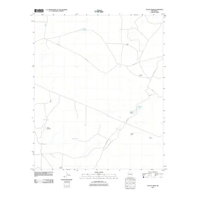
2010 Map of Coyote Draw
USGS Topo · Published 2010About this map
Red Bluff Ranch and isolated water sources define this Chaves County landscape, where the survival of ranching operations depends on a network of named wells, tanks, and windmills. The terrain is characterized by ephemeral drainage systems like Coyote Draw and Milner Draw, which feed into series of seasonal basins including Cocklebur Lakes, Coons Lake, and Yellow Lake. These geographic depressions, such as the Yellow Lake Sink, indicate the subtle but critical hydrology of the high plains. Infrastructure is sparse, primarily consisting of graded routes like Red Bluff Rd and County Rd 100 that connect remote outposts. Industrial activity is represented by the Acme Sand Pit in the southeast, while family-named features like Smith Windmill, Savage Well, and Dixon Well provide essential data points for genealogists and local historians tracing land use and water rights in this arid region.
Find a feature on this map
21 named features on this map. Tap any name to fly to it.
Don’t see what you’re looking for? This feature index may not catch every label — zoom into the map to look around manually.
Map Details
Editions of this 2010 Coyote Draw Map
This is the sole edition of this map. No revisions or reprints were ever made.
Other maps of this area

1955 · Roswell
USGS Topo · 1:250,000

1958 · Roswell
USGS Topo · 1:250,000

1962 · Roswell
USGS Topo · 1:250,000

1962 · Eightmile Draw
USGS Topo · 1:24,000

1962 · Panther Hill
USGS Topo · 1:24,000

1962 · Acme
USGS Topo · 1:24,000
1962 · Melena
USGS Topo · 1:24,000

1962 · Marley Draw
USGS Topo · 1:24,000

1963 · Coyote Draw
USGS Topo · 1:24,000

1967 · Cottonwood Draw
USGS Topo · 1:24,000