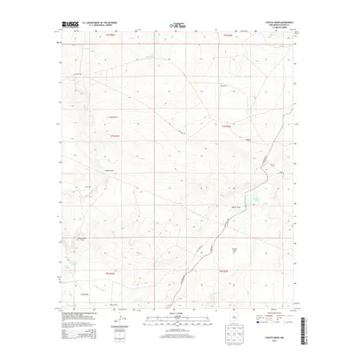
2013 Map of Coyote Draw
USGS Topo · Published 2013About this map
Coyote Draw and Milner Draw define the drainage patterns across this arid stretch of Chaves County, where water management is central to the landscape. The map illustrates a network of ranching infrastructure including Savage Well, Dixon Well, and the Smith Windmill, highlighting the reliance on groundwater in the high desert. Settlement is sparse, anchored by the Red Bluff Ranch and connected by unpaved routes like Red Bluff Rd and Cottonwood Rd.
Find a feature on this map
26 named features on this map. Tap any name to fly to it.
Don’t see what you’re looking for? This feature index may not catch every label — zoom into the map to look around manually.
Map Details
Editions of this 2013 Coyote Draw Map
This is the sole edition of this map. No revisions or reprints were ever made.
Other maps of this area

1955 · Roswell
USGS Topo · 1:250,000

1958 · Roswell
USGS Topo · 1:250,000

1962 · Roswell
USGS Topo · 1:250,000

1962 · Eightmile Draw
USGS Topo · 1:24,000

1962 · Panther Hill
USGS Topo · 1:24,000

1962 · Acme
USGS Topo · 1:24,000
1962 · Melena
USGS Topo · 1:24,000

1962 · Marley Draw
USGS Topo · 1:24,000

1963 · Coyote Draw
USGS Topo · 1:24,000

1967 · Cottonwood Draw
USGS Topo · 1:24,000