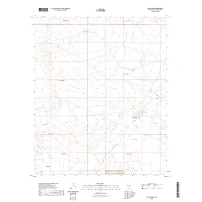
2023 Map of Coyote Draw
USGS Topo · Published 2023About this map
Bitter Lake National Wildlife Refuge and the Salt Creek Wilderness anchor the southern boundary of this arid basin in Chaves County. The landscape is defined by its intermittent hydrology, where drainage features like Milner Draw and Coyote Draw lead toward a series of ephemeral basins and sinks. Notable among these are Cocklebur Lakes, Coons Lake, and Yellow Lake Sink, which characterize the high-desert terrain north of Roswell.
Find a feature on this map
25 named features on this map. Tap any name to fly to it.
Don’t see what you’re looking for? This feature index may not catch every label — zoom into the map to look around manually.
Map Details
Editions of this 2023 Coyote Draw Map
This is the sole edition of this map. No revisions or reprints were ever made.
Other maps of this area

1955 · Roswell
USGS Topo · 1:250,000

1958 · Roswell
USGS Topo · 1:250,000

1962 · Roswell
USGS Topo · 1:250,000

1962 · Eightmile Draw
USGS Topo · 1:24,000

1962 · Panther Hill
USGS Topo · 1:24,000

1962 · Acme
USGS Topo · 1:24,000
1962 · Melena
USGS Topo · 1:24,000

1962 · Marley Draw
USGS Topo · 1:24,000

1963 · Coyote Draw
USGS Topo · 1:24,000

1967 · Cottonwood Draw
USGS Topo · 1:24,000