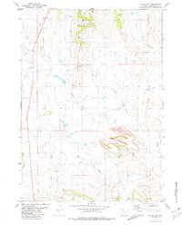
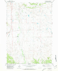
1981 Map of Coyote Gap
USGS Topo · Published 1981About this map
Coyote Gap serves as a prominent landmark within the high plains of Niobrara County, where the elevation rises significantly into the Seaman Hills. This landscape is defined by a dendritic drainage network of ephemeral streams and draws, including Old Woman Creek, Alum Creek, and Coyote Creek. The presence of several Drill Holes and a Gravel Pit indicate localized industrial activity and resource extraction during the mid-1970s. A prominent Pipeline cuts through the western section of the map, following the general path of the creek beds. The transition from the flat draws like Sand Draw and Hales Draw to the more broken terrain of the hills reveals the characteristic topography of this eastern Wyoming cattle country before more modern infrastructure intensified.
Find a feature on this map
17 named features on this map. Tap any name to fly to it.
Don’t see what you’re looking for? This feature index may not catch every label — zoom into the map to look around manually.
Map Details
Editions of this 1981 Coyote Gap Map
This is the sole edition of this map. No revisions or reprints were ever made.
Other maps of this area

1954 · Torrington
USGS Topo · 1:250,000

1955 · Newcastle
USGS Topo · 1:250,000

1958 · Torrington
USGS Topo · 1:250,000

1958 · Newcastle
USGS Topo · 1:250,000

1978 · Shepherds Point
USGS Topo · 1:24,000
1978 · Oat Creek NW
USGS Topo · 1:24,000
1978 · South Oat Creek
USGS Topo · 1:24,000

1981 · Telephone Draw
USGS Topo · 1:24,000
1981 · Hat Rock
USGS Topo · 1:24,000
1981 · Hat Creek
USGS Topo · 1:24,000