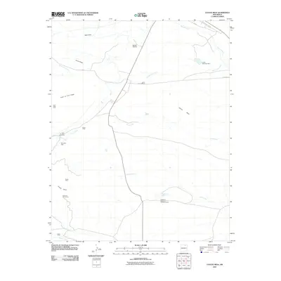
2010 Map of Coyote Mesa
USGS Topo · Published 2010About this map
Coyote Mesa and the expansive Urraca Mesa define this high-altitude landscape in Colfax County, where the terrain is marked by the rugged drainage systems of Cimarroncito Creek, Urraca Creek, and Chicoso Creek. The map documents a significant network of wilderness camps, likely associated with the region's scouting heritage, including Rocky Mountain Scout Camp, Tooth Ridge Camp, and Urraca Camp. Water management is central to this environment, as evidenced by the engineering of Hagardorn Reservoir Number 5 Dam and Lewis Reservoir Dam. Prominent geological features like Tooth of Time Ridge and Horse Ridge provide a sense of the dramatic verticality of the area. Named grazing lands such as Buffalo Pasture indicate the historical and contemporary use of these mesas for livestock, while localized landmarks like Toothache Spring Camp and Nash Gulch offer points of interest for those tracking family lore or regional history in the Sangre de Cristo foothills.
Find a feature on this map
26 named features on this map. Tap any name to fly to it.
Don’t see what you’re looking for? This feature index may not catch every label — zoom into the map to look around manually.
Map Details
Editions of this 2010 Coyote Mesa Map
This is the sole edition of this map. No revisions or reprints were ever made.
Other maps of this area

1954 · Raton
USGS Topo · 1:250,000

1955 · Cimarron
USGS Topo · 1:62,500

1955 · Ute Park
USGS Topo · 1:62,500

1956 · Tooth Of Time
USGS Topo · 1:62,500

1956 · Miami
USGS Topo · 1:62,500

1958 · Raton
USGS Topo · 1:250,000

1981 · Springer
USGS Topo · 1:100,000

1981 · Raton
USGS Topo · 1:100,000

1982 · Wheeler Peak
USGS Topo · 1:100,000

1983 · Taos
USGS Topo · 1:100,000