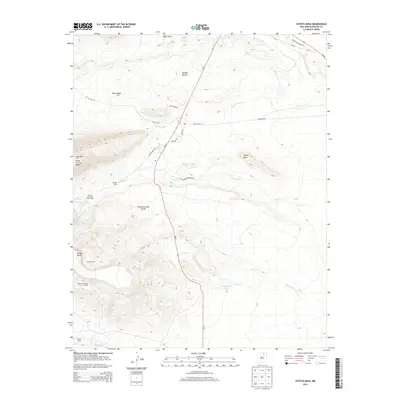
2013 Map of Coyote Mesa
USGS Topo · Published 2013About this map
Philmont Scout Ranch anchors this high-desert landscape in Colfax County, where the southern Sangre de Cristo Mountains transition into the sweeping plateaus of Coyote Mesa and Urraca Mesa. The terrain is defined by dramatic vertical relief, notably at the Tooth of Time Ridge, a landmark that has guided travelers for generations. This area is a significant hub for outdoor education and regional history, featuring a network of backcountry camps such as Urraca Camp, Zastro Camp, and Rocky Mountain Scout Camp. Water remains the most critical resource in this arid environment, marked by the courses of the Cimarron River and Rayado Cr, as well as uniquely named landmarks like Toothache Spring and Backache Spring. The map reflects a landscape managed for both ranching and recreation, with roads like Cattle Headquarters Rd and Opportunidad Rd connecting the remote Buffalo Pasture to state routes.
Find a feature on this map
35 named features on this map. Tap any name to fly to it.
Don’t see what you’re looking for? This feature index may not catch every label — zoom into the map to look around manually.
Map Details
Editions of this 2013 Coyote Mesa Map
This is the sole edition of this map. No revisions or reprints were ever made.
Other maps of this area

1954 · Raton
USGS Topo · 1:250,000

1955 · Cimarron
USGS Topo · 1:62,500

1955 · Ute Park
USGS Topo · 1:62,500

1956 · Tooth Of Time
USGS Topo · 1:62,500

1956 · Miami
USGS Topo · 1:62,500

1958 · Raton
USGS Topo · 1:250,000

1981 · Springer
USGS Topo · 1:100,000

1981 · Raton
USGS Topo · 1:100,000

1982 · Wheeler Peak
USGS Topo · 1:100,000

1983 · Taos
USGS Topo · 1:100,000