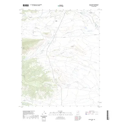
2023 Map of Coyote Mesa
USGS Topo · Published 2023About this map
Cimarron sits at the edge of the high plains where the Cimarron River meets the dramatic rising topography of the Sangre de Cristo foothills. The landscape is defined by massive flat-topped formations like Coyote Mesa and Urraca Mesa, punctuated by the sharp prominence of the Tooth of Time Ridge. This area contains a network of local routes such as Cito RD and Baubien RD that connect scattered water sources and landmarks.
Find a feature on this map
21 named features on this map. Tap any name to fly to it.
Don’t see what you’re looking for? This feature index may not catch every label — zoom into the map to look around manually.
Map Details
Editions of this 2023 Coyote Mesa Map
This is the sole edition of this map. No revisions or reprints were ever made.
Other maps of this area

1954 · Raton
USGS Topo · 1:250,000

1955 · Cimarron
USGS Topo · 1:62,500

1955 · Ute Park
USGS Topo · 1:62,500

1956 · Tooth Of Time
USGS Topo · 1:62,500

1956 · Miami
USGS Topo · 1:62,500

1958 · Raton
USGS Topo · 1:250,000

1981 · Springer
USGS Topo · 1:100,000

1981 · Raton
USGS Topo · 1:100,000

1982 · Wheeler Peak
USGS Topo · 1:100,000

1983 · Taos
USGS Topo · 1:100,000