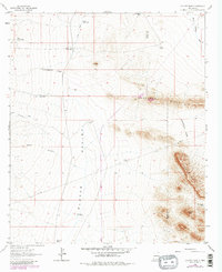
1964 Map of Coyote Peak
USGS Topo · Published 1980About this map
The Continental Divide winds through this high-desert landscape in southwestern New Mexico, marking the geographic spine of the Playas Valley. At the time of this survey, the area was defined by a network of water-management infrastructure essential for ranching and livestock, including numerous catchments like Lower Camp Tank, South Tank, and New Coyote Tank. Sparse ranching outposts such as Bertoglio-Merrill Ranch and the Diamond A Ranch anchored the remote terrain, supported by isolated landmarks like the Lone Hill Windmill.
Find a feature on this map
23 named features on this map. Tap any name to fly to it.
Don’t see what you’re looking for? This feature index may not catch every label — zoom into the map to look around manually.
Map Details
Editions of this 1964 Coyote Peak Map
2 editions found
Other maps of this area

1918 · Hachita
USGS Topo · 1:62,500

1918 · Playas
USGS Topo · 1:62,500

1919 · Playas
USGS Topo · 1:62,500

1954 · Silver City
USGS Topo · 1:250,000

1955 · Douglas
USGS Topo · 1:250,000

1958 · Silver City
USGS Topo · 1:250,000

1959 · Douglas
USGS Topo · 1:250,000

1961 · Douglas
USGS Topo · 1:250,000

1962 · Silver City
USGS Topo · 1:250,000

1964 · Douglas
USGS Topo · 1:250,000