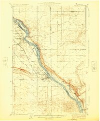
1965 Map of Coyote Rapids
USGS Topo · Published 1980About this map
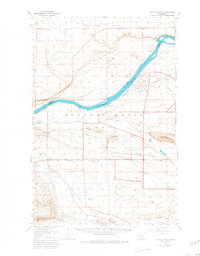
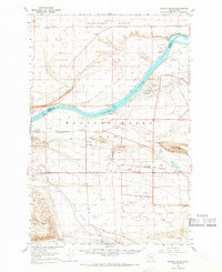
The Hanford Works (AEC) dominates this mid-1960s landscape, illustrating a heavily controlled government industrial landscape along the Columbia River. The map meticulously details the infrastructure required for the Atomic Energy Commission's operations, including the extensive U. S. Govt. Railroad and numerous test wells scattered across the Cold Creek Valley. Small named nodes like Allard, Riverland, and Susie appear alongside operational facilities such as the Yakima Barricade and a Fire Station, marking a unique intersection of former civilian settlements and high-security military-industrial development. The natural terrain remains prominent through the Wahluke Slope and Sand Dunes, while the Hanford Ditch and Rattlesnake Spring point to the critical management of water in this arid reach of the Columbia basin.
Find a feature on this map
32 named features on this map. Tap any name to fly to it.
Don’t see what you’re looking for? This feature index may not catch every label — zoom into the map to look around manually.
Map Details
Editions of this 1965 Coyote Rapids Map
2 editions found
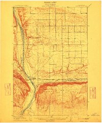
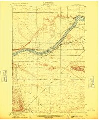
Other maps of this area

1911 · Red Rock
USGS Topo · 1:62,500
1912 · Beverly
USGS Topo · 1:62,500

1915 · Prosser
USGS Topo · 1:125,000
1916 · Coyote Rapids
USGS Topo · 1:62,500

1917 · Pasco
USGS Topo · 1:125,000

1917 · Priest Rapids
USGS Topo · 1:62,500

1917 · Prosser
USGS Topo · 1:125,000

1923 · Corfu
USGS Topo · 1:62,500
1924 · Hanford
USGS Topo · 1:62,500
1948 · Emerson Nipple
USGS Topo · 1:24,000