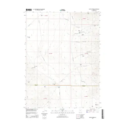
2014 Map of Coyote Springs
USGS Topo · Published 2014About this map
The Pony Express Rd traces the northern reaches of this Tooele County landscape, a reminder of the historical transit corridor through the Utah desert. This 2014 survey captures a terrain defined by ancient geological features and isolated water sources, most notably the Old River Bed which winds through the center of the sheet. To the east, the Simpson Mountains rise abruptly, featuring steep drainages like Footes Canyon and Lost Canyon.
Find a feature on this map
48 named features on this map. Tap any name to fly to it.
Don’t see what you’re looking for? This feature index may not catch every label — zoom into the map to look around manually.
Map Details
Editions of this 2014 Coyote Springs Map
This is the sole edition of this map. No revisions or reprints were ever made.
Other maps of this area

1885 · Sevier Desert
USGS Topo · 1:250,000

1885 · Tooele Valley
USGS Topo · 1:250,000

1953 · Tooele
USGS Topo · 1:250,000

1953 · Delta
USGS Topo · 1:250,000

1955 · Camels Back Ridge SW
USGS Topo · 1:24,000

1955 · Simpson Springs
USGS Topo · 1:24,000

1955 · Indian Peaks
USGS Topo · 1:24,000

1955 · Indian Springs
USGS Topo · 1:24,000
1955 · Table Mountain
USGS Topo · 1:24,000

1955 · Coyote Springs
USGS Topo · 1:24,000