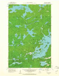
1956 Map of Crab Lake
USGS Topo · Published 1961About this map
Superior National Forest and the Burnt Side State Forest converge in this mid-century survey of the Iron Range region. The landscape is defined by an intricate network of glacial lakes and portages, centered on the sprawling, irregular arms of Crab Lake and the northern reaches of Burnt Side Lake. This 1956 field check documents the area's wilderness character just as modern conservation boundaries were being formalized, showing the intersection of state and federal forest lands. Waterways like the Korb River connect smaller basins such as Cummings Lake and Little Crab Lake, while significant landforms like Pine Island and Shellman Island break the surface of the larger lakes. To the south, the map touches the edge of Breitung, illustrating the transition from the lake-heavy wilderness toward the industrial footprint of the iron mining districts.
Find a feature on this map
53 named features on this map. Tap any name to fly to it.
Don’t see what you’re looking for? This feature index may not catch every label — zoom into the map to look around manually.
Map Details
Editions of this 1956 Crab Lake Map
3 editions found
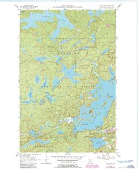
Other maps of this area

1933 · Ely
USGS Topo · 1:62,500

1939 · Ely
USGS Topo · 1:62,500

1954 · Two Harbors
USGS Topo · 1:250,000

1954 · Hibbing
USGS Topo · 1:250,000

1954 · International Falls
USGS Topo · 1:250,000

1956 · Chad Lake
USGS Topo · 1:24,000
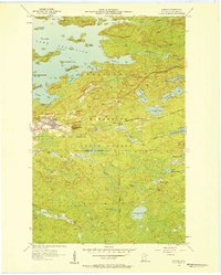
1956 · Soudan
USGS Topo · 1:24,000

1956 · Crab Lake
USGS Topo · 1:24,000

1956 · Eagles Nest
USGS Topo · 1:24,000

1957 · Two Harbors
USGS Topo · 1:250,000