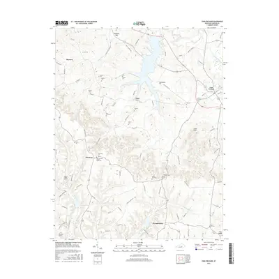
2016 Map of Crab Orchard
USGS Topo · Published 2016About this map
Crab Orchard and the surrounding Lincoln County landscape are defined by a network of rural settlements and historic family burial grounds. The community of Ottenheim stands out for its cultural markers, specifically the Saint Sylvesters Catholic Church Cem and the Reformed Cem, reflecting the area's heritage. To the south, Broughtentown and Dog Walk anchor the lower elevations near the winding path of Crab Orchard Cr. The terrain is punctuated by significant rises such as Sportsmans Hill and Collier Knob, which overlook a complex system of waterways including the Dix River and Cedar Cr. Genealogists will find a wealth of specific local history through numerous small plots like the Whitley Graveyard, Abron Cem, and Tucker Cem, which are scattered throughout the hills of Sugar Grove and Walnut Flat.
Find a feature on this map
92 named features on this map. Tap any name to fly to it.
Don’t see what you’re looking for? This feature index may not catch every label — zoom into the map to look around manually.
Map Details
Editions of this 2016 Crab Orchard Map
This is the sole edition of this map. No revisions or reprints were ever made.
Other maps of this area

1892 · Richmond
USGS Topo · 1:125,000

1893 · London
USGS Topo · 1:125,000

1897 · Richmond
USGS Topo · 1:125,000

1897 · London
USGS Topo · 1:125,000

1905 · Harrodsburg
USGS Topo · 1:125,000

1952 · Halls Gap
USGS Topo · 1:24,000

1952 · Eubank
USGS Topo · 1:24,000

1952 · Crab Orchard
USGS Topo · 1:24,000

1952 · Paint Lick
USGS Topo · 1:24,000

1952 · Lancaster
USGS Topo · 1:24,000