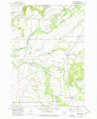
1970 Map of Crabtree
USGS Topo · Published 1978About this map
McKinney Bottom and the fertile floodplains of the Santiam River system define this portion of the Willamette Valley during the early 1970s. The landscape is a complex network of moving water and irrigation, where the North Santiam River and South Santiam River converge amidst a web of sloughs and man-made channels like the Jefferson Ditch. This geography dictated the placement of early settlements and transport, with the Southern Pacific railroad threading through Crabtree and West Scio to serve the agricultural hinterland.
Find a feature on this map
43 named features on this map. Tap any name to fly to it.
Don’t see what you’re looking for? This feature index may not catch every label — zoom into the map to look around manually.
Map Details
Editions of this 1970 Crabtree Map
2 editions found
Other maps of this area

1911 · Lebanon
USGS Topo · 1:31,680

1911 · Tangent
USGS Topo · 1:31,680

1912 · Jefferson
USGS Topo · 1:31,680

1915 · Sidney
USGS Topo · 1:31,680

1916 · Albany
USGS Topo · 1:62,500

1917 · Salem
USGS Topo · 1:62,500

1921 · Lebanon
USGS Topo · 1:62,500

1922 · Lebanon
USGS Topo · 1:48,000

1924 · Lebanon
USGS Topo · 1:62,500

1925 · Stayton
USGS Topo · 1:62,500