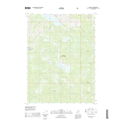
2017 Map of Craig B-3 NW
USGS Topo · Published 2017About this map
Tongass National Forest dominates this section of Prince of Wales Island, revealing a landscape defined by its complex hydrology and dense timber. The settlement of Port Saint Nicholas sits at the edge of the coastal topography, serving as a focal point for activity in an area otherwise characterized by interior waterways and high ridges. Significant water bodies including Klawock Lake and Lake Saint Nicholas are connected by systems like the Klawock River and Harris River, which have long shaped the transit and resource patterns of the region. Distinctive place names such as Gandlaay Haanaa reflect the local heritage, while infrastructure like the Upper W. Ridge road and W Trocadero trail trace the paths of forest management and backcountry access through the unorganized borough.
Find a feature on this map
18 named features on this map. Tap any name to fly to it.
Don’t see what you’re looking for? This feature index may not catch every label — zoom into the map to look around manually.
Map Details
Editions of this 2017 Craig B-3 NW Map
This is the sole edition of this map. No revisions or reprints were ever made.
Other maps of this area

1949 · Craig B-3
USGS Topo · 1:63,360

1949 · Craig C-3
USGS Topo · 1:63,360

1949 · Craig C-4
USGS Topo · 1:63,360

1949 · Craig B-4
USGS Topo · 1:63,360

1951 · Craig C-3
USGS Topo · 1:63,360

1951 · Craig B-4
USGS Topo · 1:63,360

1951 · Craig C-4
USGS Topo · 1:63,360

1951 · Craig B-3
USGS Topo · 1:63,360

1957 · Craig
USGS Topo · 1:250,000
1994 · Craig C-3
USGS Topo · 1:63,360