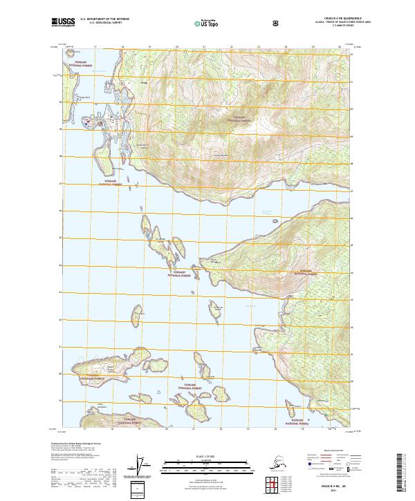
2021 Map of Craig B-4 NE
USGS Topo · Published 2021About this map
Craig serves as the primary hub in this coastal landscape, situated on a narrow peninsula protected by Fish Egg Reef and Craig Island. The town's grid is defined by Main Street, Beach Road, and Port Bagial Blvd, reflecting its orientation toward the waters of Klawock Inlet. To the east, the Sunnahae Mountain Trl ascends toward the peak of Sunny Hay Mtn, overlooking a complex archipelago. This maritime environment, largely contained within the Tongass National Forest, is characterized by numerous islands such as the Coronados Islands, Madre de Dios Island, and the Ladrones Islands. The presence of a Cem near the town center and various named coastal points like Point Iphigenia and Cape Suspiro suggests a landscape where settlement and navigation are deeply tied to the rugged shoreline of Prince of Wales Island.
Find a feature on this map
38 named features on this map. Tap any name to fly to it.
Don’t see what you’re looking for? This feature index may not catch every label — zoom into the map to look around manually.
Map Details
Editions of this 2021 Craig B-4 NE Map
This is the sole edition of this map. No revisions or reprints were ever made.
Other maps of this area

1949 · Craig B-3
USGS Topo · 1:63,360

1949 · Craig C-3
USGS Topo · 1:63,360

1949 · Craig C-4
USGS Topo · 1:63,360

1949 · Craig B-4
USGS Topo · 1:63,360

1951 · Craig C-3
USGS Topo · 1:63,360

1951 · Craig B-4
USGS Topo · 1:63,360

1951 · Craig C-4
USGS Topo · 1:63,360

1951 · Craig B-3
USGS Topo · 1:63,360

1957 · Craig
USGS Topo · 1:250,000
1994 · Craig C-3
USGS Topo · 1:63,360