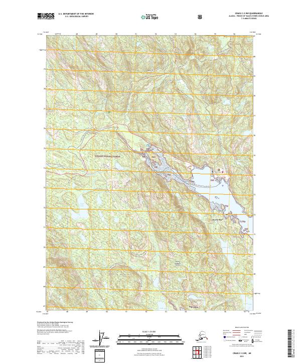
2021 Map of Craig C-2 NW
USGS Topo · Published 2021About this map
Tongass National Forest dominates this section of Prince of Wales Island, where a dense network of water bodies and trails defines the interior. The settlement of Salt Chuck sits at the southern edge, connected to the wider island by the Kasaan Road and Lake Ellen Road. A significant corridor for wilderness travel is the Honker Divide Canoe Route Trl, which navigates through the Thorne River and into the tidal waters of Thorne Bay.
Find a feature on this map
62 named features on this map. Tap any name to fly to it.
Don’t see what you’re looking for? This feature index may not catch every label — zoom into the map to look around manually.
Map Details
Editions of this 2021 Craig C-2 NW Map
This is the sole edition of this map. No revisions or reprints were ever made.
Other maps of this area

1949 · Craig D-3
USGS Topo · 1:63,360

1949 · Craig C-2
USGS Topo · 1:63,360

1949 · Craig D-2
USGS Topo · 1:63,360

1949 · Craig C-3
USGS Topo · 1:63,360

1950 · Craig D-3
USGS Topo · 1:63,360

1951 · Craig C-3
USGS Topo · 1:63,360

1951 · Craig D-2
USGS Topo · 1:63,360

1951 · Craig C-2
USGS Topo · 1:63,360

1957 · Craig
USGS Topo · 1:250,000
1994 · Craig D-3
USGS Topo · 1:63,360