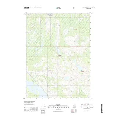
2017 Map of Craig C-3 SW
USGS Topo · Published 2017About this map
Tongass National Forest dominates this Alaskan landscape, where steep coastal terrain meets the intricate waterways of Prince of Wales Island. The southeastern corner of the map features the significant elevation of Pin Peak, overlooking the headwaters of McGillvery Cr. In the northern and central sections, high-elevation alpine lakes like Black Lake and Black Bear Lake sit tucked within the ridges, while the larger Klawock Lake occupies the lower elevations to the southwest. The presence of Threemile Cr and other drainages illustrates the complex watershed patterns typical of the region's dense forest and maritime climate, serving as a primary record of the natural topography before any significant human development beyond the forest boundaries.
Find a feature on this map
11 named features on this map. Tap any name to fly to it.
Don’t see what you’re looking for? This feature index may not catch every label — zoom into the map to look around manually.
Map Details
Editions of this 2017 Craig C-3 SW Map
This is the sole edition of this map. No revisions or reprints were ever made.
Other maps of this area

1949 · Craig B-3
USGS Topo · 1:63,360

1949 · Craig C-3
USGS Topo · 1:63,360

1949 · Craig C-4
USGS Topo · 1:63,360

1949 · Craig B-4
USGS Topo · 1:63,360

1951 · Craig C-3
USGS Topo · 1:63,360

1951 · Craig B-4
USGS Topo · 1:63,360

1951 · Craig C-4
USGS Topo · 1:63,360

1951 · Craig B-3
USGS Topo · 1:63,360

1957 · Craig
USGS Topo · 1:250,000
1994 · Craig C-3
USGS Topo · 1:63,360