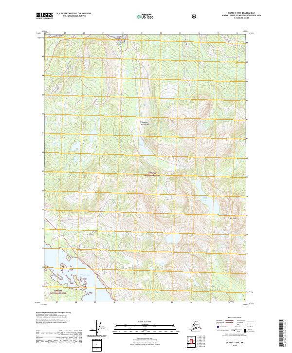
2021 Map of Craig C-3 SW
USGS Topo · Published 2021About this map
Pin Peak stands as a prominent landmark within the Tongass National Forest on this portion of the Alexander Archipelago. The landscape is defined by its dramatic elevation changes and significant water bodies, including the expansive Klawock Lake and the high-alpine Black Bear Lake. This 2021 survey illustrates the complex drainage systems of the region, where Threemile Cr and McGillvery Cr carve through steep terrain. Human presence is sparse, primarily indicated by the Lake Ellen Road and various land management designations like TNF. This map provides a detailed look at the island's timber and water resources, offering essential data for understanding the physical geography and conservation boundaries of Prince of Wales Island.
Find a feature on this map
14 named features on this map. Tap any name to fly to it.
Don’t see what you’re looking for? This feature index may not catch every label — zoom into the map to look around manually.
Map Details
Editions of this 2021 Craig C-3 SW Map
This is the sole edition of this map. No revisions or reprints were ever made.
Other maps of this area

1949 · Craig B-3
USGS Topo · 1:63,360

1949 · Craig C-3
USGS Topo · 1:63,360

1949 · Craig C-4
USGS Topo · 1:63,360

1949 · Craig B-4
USGS Topo · 1:63,360

1951 · Craig C-3
USGS Topo · 1:63,360

1951 · Craig B-4
USGS Topo · 1:63,360

1951 · Craig C-4
USGS Topo · 1:63,360

1951 · Craig B-3
USGS Topo · 1:63,360

1957 · Craig
USGS Topo · 1:250,000
1994 · Craig C-3
USGS Topo · 1:63,360