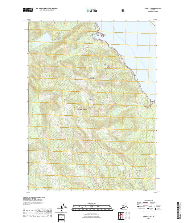
2021 Map of Craig D-2 SW
USGS Topo · Published 2021About this map
Prince of Wales Island in the Alexander Archipelago is defined by its complex network of forest access routes and coastal drainages within the Tongass National Forest. This 2021 survey illustrates the modern topography of a region where timber and wilderness management intersect, specifically around Big Lake and the southeastern shore near Little Ratz Harbor. The landscape is a corridor of named ridges and creek bottoms, such as Fiddler Creek and Slide Creek, which direct the flow of water toward Thorne Bay. A dense system of forestry infrastructure is visible through labels like Echo Spur and the Sal Creek Cabin Road, alongside specialized trail segments such as the Deer Creek Mid-Valley Trl. The map provides a look at the backcountry geography used for recreation and resource management in Southeast Alaska.
Find a feature on this map
46 named features on this map. Tap any name to fly to it.
Don’t see what you’re looking for? This feature index may not catch every label — zoom into the map to look around manually.
Map Details
Editions of this 2021 Craig D-2 SW Map
This is the sole edition of this map. No revisions or reprints were ever made.
Other maps of this area

1949 · Craig D-3
USGS Topo · 1:63,360

1949 · Craig C-2
USGS Topo · 1:63,360

1949 · Craig D-2
USGS Topo · 1:63,360

1949 · Craig C-3
USGS Topo · 1:63,360

1950 · Craig D-3
USGS Topo · 1:63,360

1951 · Craig C-3
USGS Topo · 1:63,360

1951 · Craig D-2
USGS Topo · 1:63,360

1951 · Craig C-2
USGS Topo · 1:63,360

1957 · Craig
USGS Topo · 1:250,000
1994 · Craig D-3
USGS Topo · 1:63,360