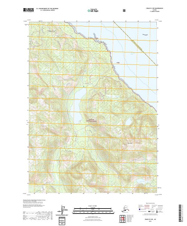
2021 Map of Craig D-3 NE
USGS Topo · Published 2021About this map
Coffman Cove sits at the northern edge of this coastal landscape, serving as a primary point of entry for the logging and forest roads that weave through the Tongass National Forest. The map detail shows an intricate network of timber-access routes like the Coffman Cove Loop and numerous numbered road trails, such as 3030112 Road Trl, which penetrate the dense terrain. The geography is dominated by the massive Luck Lake and the steep elevation of Baird Peak. To the east, the shoreline meets the Clarence Strait at Luck Point. Localized land features like Refrigerator Valley and North Wall illustrate a terrain defined by dramatic glacial or tectonic carving, while small water bodies like Little Lake and Eagle Creek drain the high ridges into the sea.
Find a feature on this map
46 named features on this map. Tap any name to fly to it.
Don’t see what you’re looking for? This feature index may not catch every label — zoom into the map to look around manually.
Map Details
Editions of this 2021 Craig D-3 NE Map
This is the sole edition of this map. No revisions or reprints were ever made.
Other maps of this area

1948 · Petersburg A-2
USGS Topo · 1:63,360

1949 · Craig D-3
USGS Topo · 1:63,360

1949 · Craig D-2
USGS Topo · 1:63,360

1949 · Petersburg A-3
USGS Topo · 1:63,360

1950 · Craig D-3
USGS Topo · 1:63,360

1951 · Craig D-2
USGS Topo · 1:63,360

1952 · Petersburg
USGS Topo · 1:250,000

1953 · Petersburg A-3
USGS Topo · 1:63,360

1953 · Petersburg A-2
USGS Topo · 1:63,360

1957 · Craig
USGS Topo · 1:250,000