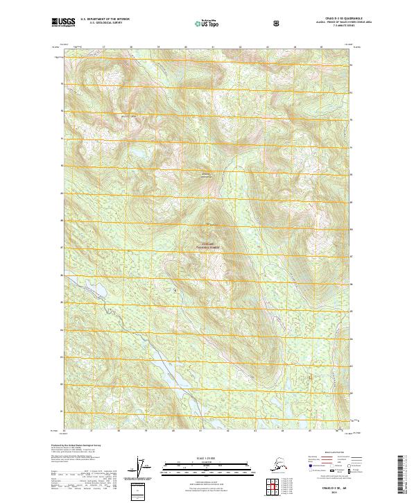
2021 Map of Craig D-3 SE
USGS Topo · Published 2021About this map
The Tongass National Forest dominates this section of the Alexander Archipelago, where the Thorne River and its various tributaries define the interior drainage of Prince of Wales Island. The landscape is characterized by steep elevations, reaching prominent heights at Manty Mtn and North Point. Waterways are the primary connective tissue of the area, notably the Honker Divide Canoe Route-Trl which winds through the valley south toward Thorne Lake.
Find a feature on this map
22 named features on this map. Tap any name to fly to it.
Don’t see what you’re looking for? This feature index may not catch every label — zoom into the map to look around manually.
Map Details
Editions of this 2021 Craig D-3 SE Map
This is the sole edition of this map. No revisions or reprints were ever made.
Other maps of this area

1949 · Craig D-3
USGS Topo · 1:63,360

1949 · Craig C-2
USGS Topo · 1:63,360

1949 · Craig D-2
USGS Topo · 1:63,360

1949 · Craig C-3
USGS Topo · 1:63,360

1950 · Craig D-3
USGS Topo · 1:63,360

1951 · Craig C-3
USGS Topo · 1:63,360

1951 · Craig D-2
USGS Topo · 1:63,360

1951 · Craig C-2
USGS Topo · 1:63,360

1957 · Craig
USGS Topo · 1:250,000
1994 · Craig D-3
USGS Topo · 1:63,360