
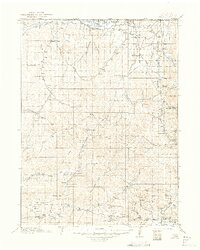
1916 Map of Craig
USGS Topo · Published 1916About this map
The Yampa River valley and the high plateau country of the Colorado-Wyoming border define this 1916 survey. The settlement of Lay sits as a central hub for ranching life in the southern portion of the quadrangle, supported by the Lay Valley School. The arrival of the Denver and Salt Lake RR along the southern corridor signifies the transition from wagon-road commerce, like the Maybell and Bagg's Road, to the industrial era. Dozens of family names are preserved across the landscape, marking isolated homesteads such as Pelleys Ranch, Blevins Ranch, and the Timberlake Ranch. The map reveals a reliance on vital water sources in this high-desert environment, detailing named features like Jackrabbit Spring, Adobe Springs, and Blue Gravel Spring. Higher elevations are punctuated by prominent landmarks including Cedar Mtn, Black Mtn, and the distinctive Sugarloaf Butte.
Find a feature on this map
70 named features on this map. Tap any name to fly to it.
Don’t see what you’re looking for? This feature index may not catch every label — zoom into the map to look around manually.
Map Details
Editions of this 1916 Craig Map
2 editions found
Other maps of this area

1907 · White River
USGS Topo · 1:125,000

1910 · Danforth Hills
USGS Topo · 1:125,000

1910 · White River
USGS Topo · 1:125,000

1912 · Axial
USGS Topo · 1:62,500

1914 · Axial
USGS Topo · 1:62,500

1915 · Monument Butte
USGS Topo · 1:62,500

1916 · Daton Peak
USGS Topo · 1:62,500

1920 · Daton Peak
USGS Topo · 1:62,500

1923 · Elkhead Creek
USGS Topo · 1:62,500

1924 · Elkhead Creek
USGS Topo · 1:62,500