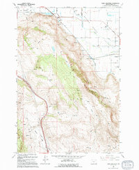
1994 Map of Craig Mountain
USGS Topo · Published 1994About this map
Craig Mountain dominates the landscape south of the Grande Ronde Valley, where the transition from high ridgelines to fertile valley floors is defined by numerous springs and seasonal waterways. At the northern foot of the mountain, the Hot Lake settlement and its namesake hot springs sit near the edge of the Ladd Marsh Game Management Area, a preserved wetland complex critical to the local ecology. The map reveals the historical transport infrastructure of Union County, tracing an Old Railroad Grade that winds through the upper elevations, signaling the importance of timber or early rail routes before modern realignments.
Find a feature on this map
30 named features on this map. Tap any name to fly to it.
Don’t see what you’re looking for? This feature index may not catch every label — zoom into the map to look around manually.
Map Details
Editions of this 1994 Craig Mountain Map
This is the sole edition of this map. No revisions or reprints were ever made.
Other maps of this area

1906 · Telocaset
USGS Topo · 1:125,000

1953 · Pendleton
USGS Topo · 1:250,000

1955 · Grangeville
USGS Topo · 1:250,000

1956 · Pendleton
USGS Topo · 1:250,000

1959 · Grangeville
USGS Topo · 1:250,000

1963 · La Grande SE
USGS Topo · 1:24,000

1965 · Conley
USGS Topo · 1:24,000
1965 · Glass Hill
USGS Topo · 1:24,000
1965 · Tucker Flat
USGS Topo · 1:24,000

1965 · Union
USGS Topo · 1:24,000