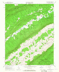
1965 Map of Craig Springs
USGS Topo · Published 1967About this map
Craig Springs serves as a focal point in this mid-1960s study of the mountainous borderland between Virginia and West Virginia. The landscape is defined by the heavy timber of the Jefferson National Forest, where steep ridges like Potts Mountain and Sweet Springs Mountain create narrow valleys that dictate the placement of rural infrastructure. The map reveals a tight-knit community network through landmarks like Craig Springs Ch, Mt Carmel Ch, and the Maywood Sch, alongside the specialized local economy represented by Valley Mill. Evidence of the region’s social history is visible in the presence of the County Farm, while the hydrography of the Johns Creek and Sinking Creek basins illustrates the complex drainage patterns of the Allegheny Highlands. The inclusion of Blue Healing Springs suggests the area's legacy as a mineral spring destination, even as the primary landscape remained dedicated to small-scale agriculture and forest management.
Find a feature on this map
60 named features on this map. Tap any name to fly to it.
Don’t see what you’re looking for? This feature index may not catch every label — zoom into the map to look around manually.
Map Details
Editions of this 1965 Craig Springs Map
2 editions found
Other maps of this area

1887 · Lewisburg
USGS Topo · 1:125,000

1890 · Christiansburg
USGS Topo · 1:125,000

1891 · Lewisburg
USGS Topo · 1:125,000

1921 · Ronceverte
USGS Topo · 1:48,000

1923 · Ronceverte
USGS Topo · 1:62,500

1923 · Waiteville
USGS Topo · 1:62,500

1929 · Salem
USGS Topo · 1:48,000

1931 · Waiteville
USGS Topo · 1:48,000

1932 · Salem
USGS Topo · 1:62,500

1944 · Waiteville
USGS Topo · 1:62,500