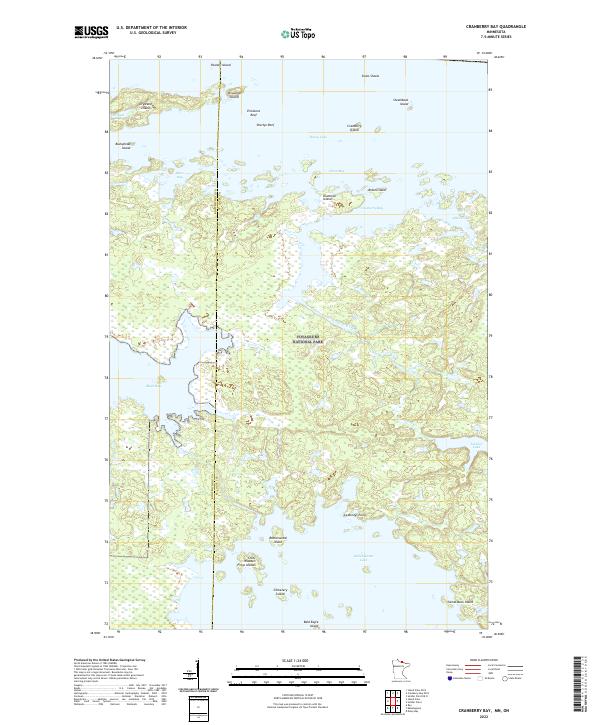
2022 Map of Cranberry Bay
USGS Topo · Published 2022About this map
Voyageurs National Park encompasses the majority of this aquatic borderland, where the boundary between Koochiching and St. Louis counties cuts through a complex network of bays and islands. The landscape is defined by the transition between major water bodies, primarily Rainy Lake in the north and Kabetogama Lake in the south, connected by interior waterways like Cranberry Creek. These waters are dotted with numerous named landforms including Chief Wooden Frogs Islands, Rottenwood Island, and Drywood Island.
Find a feature on this map
35 named features on this map. Tap any name to fly to it.
Don’t see what you’re looking for? This feature index may not catch every label — zoom into the map to look around manually.
Map Details
Editions of this 2022 Cranberry Bay Map
This is the sole edition of this map. No revisions or reprints were ever made.
Other maps of this area

1954 · International Falls
USGS Topo · 1:250,000

1957 · International Falls
USGS Topo · 1:250,000

1958 · International Falls
USGS Topo · 1:250,000

1968 · Soldier Point
USGS Topo · 1:24,000

1968 · Daley Bay
USGS Topo · 1:24,000

1969 · Island View
USGS Topo · 1:24,000

1969 · Ray
USGS Topo · 1:24,000

1969 · Cranberry Bay
USGS Topo · 1:24,000

1969 · Kabetogama
USGS Topo · 1:24,000
1978 · International Falls
USGS Topo · 1:100,000