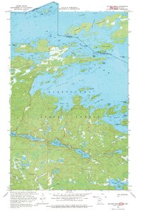
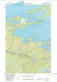
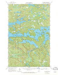
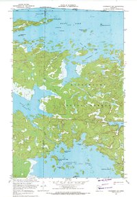
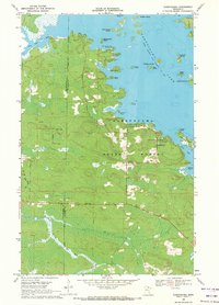
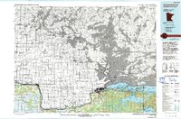
1968 Map of Soldier Point
USGS Topo · Published 1971About this map
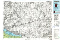
Brule Narrows serves as a critical aquatic corridor in the late 1960s, connecting the open waters of Rainy Lake across the international boundary between Ontario and Minnesota. This borderland is defined by a dense archipelago of named islands including Soldier Point, Pater Noster Island, and Kawawia Island, which has a designated campground at its eastern edge. South of the narrows, the landscape transitions into the heavily forested interior of the Superior National Forest.
Find a feature on this map
45 named features on this map. Tap any name to fly to it.
Don’t see what you’re looking for? This feature index may not catch every label — zoom into the map to look around manually.
Map Details
Editions of this 1968 Soldier Point Map
2 editions found
Other maps of this area

1954 · International Falls
USGS Topo · 1:250,000

1957 · International Falls
USGS Topo · 1:250,000

1958 · International Falls
USGS Topo · 1:250,000
1967 · Kempton Bay
USGS Topo · 1:24,000
1968 · Daley Bay
USGS Topo · 1:24,000
1968 · Ash River NE
USGS Topo · 1:24,000
1969 · Cranberry Bay
USGS Topo · 1:24,000
1969 · Kabetogama
USGS Topo · 1:24,000
1978 · International Falls
USGS Topo · 1:100,000
1978 · Brule Narrows
USGS Topo · 1:100,000