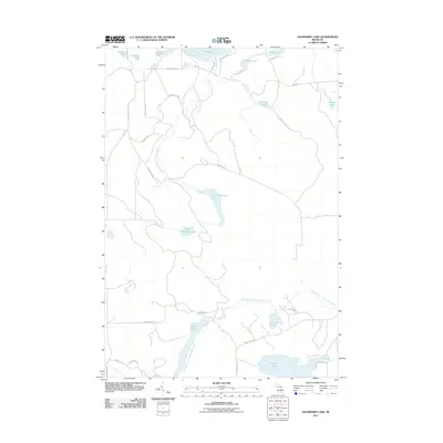
2011 Map of Cranberry Lake
USGS Topo · Published 2011About this map
The North Branch Thunder Bay River and the West Branch Upper Rainy River define the hydrography of this northern Michigan landscape. This 2011 survey records a region dominated by a complex network of glacial lakes and wetlands, including Lower Tomahawk Lake, Upper Tomahawk Lake, and the expansive Grass Lake. The road network is largely composed of local routes like County Rd 628 and named trails such as Turkey Foot Trl and Greenville Trl, suggesting a focus on forestry or recreational access. Significant water bodies such as Cranberry Lake and Rainy Lake provide clear markers for property researchers or local historians tracking the development of Case Township in Presque Isle County. The presence of smaller lakes like Hessler Lake and Krauth Lake further illustrates the dense lacustrine environment typical of this part of the state.
Find a feature on this map
37 named features on this map. Tap any name to fly to it.
Don’t see what you’re looking for? This feature index may not catch every label — zoom into the map to look around manually.
Map Details
Editions of this 2011 Cranberry Lake Map
This is the sole edition of this map. No revisions or reprints were ever made.
Other maps of this area

1954 · Alpena
USGS Topo · 1:250,000

1955 · Atlanta
USGS Topo · 1:62,500

1955 · Hillman
USGS Topo · 1:62,500

1955 · Cheboygan
USGS Topo · 1:250,000

1957 · Alpena
USGS Topo · 1:250,000

1957 · Onaway
USGS Topo · 1:62,500

1958 · Cheboygan
USGS Topo · 1:250,000

1958 · Alpena
USGS Topo · 1:250,000

1969 · Alpena
USGS Topo · 1:250,000

1971 · Hawks
USGS Topo · 1:24,000
Featured Places
- Case Township, MI
- Montmorency Township, MI
- Bismarck Township, MI
- Allis Township, MI
- Presque Isle County, MI