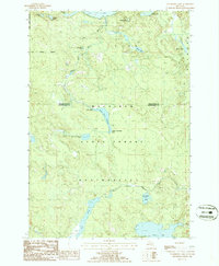
1986 Map of Cranberry Lake
USGS Topo · Published 1986About this map
Mackinaw State Forest dominates this landscape along the boundary of Presque Isle and Montmorency counties, characterized by an intricate network of glacial lakes and river systems. The hydrological heart of the area is the Rainy River, which is interrupted by the Rainy River Dam and expands into the Rainy River Flooding. This 1980s provisional study captures a wilderness used for both conservation and private recreation, as evidenced by a secluded Landing Strip (Pvt) near the northern border. To the south, the terrain drains through the North Branch Thunder Bay River, connecting numerous small basins including Cranberry Lake and Rush Lake. The map serves as a detailed record of water management and forest boundaries in the northern Lower Peninsula during the late twentieth century.
Find a feature on this map
24 named features on this map. Tap any name to fly to it.
Don’t see what you’re looking for? This feature index may not catch every label — zoom into the map to look around manually.
Map Details
Editions of this 1986 Cranberry Lake Map
This is the sole edition of this map. No revisions or reprints were ever made.
Other maps of this area

1954 · Alpena
USGS Topo · 1:250,000

1955 · Atlanta
USGS Topo · 1:62,500

1955 · Hillman
USGS Topo · 1:62,500

1955 · Cheboygan
USGS Topo · 1:250,000

1957 · Alpena
USGS Topo · 1:250,000

1957 · Onaway
USGS Topo · 1:62,500

1958 · Cheboygan
USGS Topo · 1:250,000

1958 · Alpena
USGS Topo · 1:250,000

1969 · Alpena
USGS Topo · 1:250,000

1971 · Hawks
USGS Topo · 1:24,000
Featured Places
- Bismarck Township, MI
- Allis Township, MI
- Montmorency Township, MI
- Case Township, MI
- Presque Isle County, MI