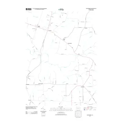
2013 Map of Cranberry
USGS Topo · Published 2013About this map
Egypt Corners and Cranberry serve as central nodes in this Venango County landscape, where rural settlement patterns follow the winding path of the E Sandy Cr and its many tributaries. The area is defined by a network of named corners and small communities such as Hill City, Nickleville, and Pittsville, many of which developed at the intersections of historic local roads like Meadow Church Rd and Valley Church Rd.
Find a feature on this map
102 named features on this map. Tap any name to fly to it.
Don’t see what you’re looking for? This feature index may not catch every label — zoom into the map to look around manually.
Map Details
Editions of this 2013 Cranberry Map
This is the sole edition of this map. No revisions or reprints were ever made.
Other maps of this area

1907 · Foxburg
USGS Topo · 1:62,500

1908 · Foxburg
USGS Topo · 1:62,500

1909 · Franklin
USGS Topo · 1:62,500

1910 · Hilliards
USGS Topo · 1:62,500

1911 · Franklin
USGS Topo · 1:62,500

1912 · Hilliards
USGS Topo · 1:62,500

1922 · Oil City
USGS Topo · 1:48,000

1924 · Oil City
USGS Topo · 1:62,500

1943 · Oil City
USGS Topo · 1:62,500

1944 · Hilliards
USGS Topo · 1:62,500
Featured Places
- Cranberry Township, PA
- Rockland Township, PA
- Maple Shade, Cranberry Township
- Barrs Corners, Rockland Township
- Hill City, Cranberry Township