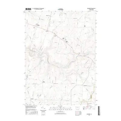
2016 Map of Cranberry
USGS Topo · Published 2016About this map
East Sandy Creek and its many tributaries, including Shaw Run and Pine Run, carve through this section of the Allegheny plateau southeast of Oil City. The landscape is defined by small, dispersed rural settlements and crossroads that have persisted through generations, such as Cranberry, Nickleville, and Barrs Corners. The terrain is significantly marked by the N Country National Scenic Trail, which winds across the central drainage basins, passing near historic corridors like Slab Furnace.
Find a feature on this map
106 named features on this map. Tap any name to fly to it.
Don’t see what you’re looking for? This feature index may not catch every label — zoom into the map to look around manually.
Map Details
Editions of this 2016 Cranberry Map
This is the sole edition of this map. No revisions or reprints were ever made.
Other maps of this area

1907 · Foxburg
USGS Topo · 1:62,500

1908 · Foxburg
USGS Topo · 1:62,500

1909 · Franklin
USGS Topo · 1:62,500

1910 · Hilliards
USGS Topo · 1:62,500

1911 · Franklin
USGS Topo · 1:62,500

1912 · Hilliards
USGS Topo · 1:62,500

1922 · Oil City
USGS Topo · 1:48,000

1924 · Oil City
USGS Topo · 1:62,500

1943 · Oil City
USGS Topo · 1:62,500

1944 · Hilliards
USGS Topo · 1:62,500
Featured Places
- Cranberry Township, PA
- Rockland Township, PA
- Maple Shade, Cranberry Township
- Barrs Corners, Rockland Township
- Hill City, Cranberry Township