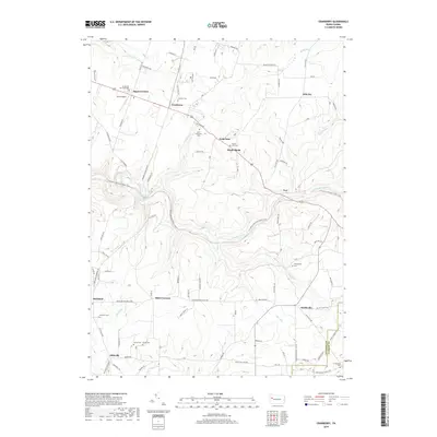
2019 Map of Cranberry
USGS Topo · Published 2019About this map
Cranberry serves as a central hub in this portion of Venango County, where established settlements like Twin Oaks, Maple Shade, and Egypt Corners dot the landscape. The region's history is preserved in its numerous rural burial grounds, including Saint Catherines Cem, Mount Zion Cem, and Brandon Cem. This modern survey illustrates a network of local roads and trails crossing over significant waterways such as East Sandy Creek and Halls Run. Near Egypt Corners, the Eakin Airport provides a clear landmark of local aviation history. To the south, the terrain becomes increasingly defined by the many runs and creeks that feed into the larger valley systems, with small crossroads communities like Barrs Corners and Nickleville marking the intersections of travel. The map also delineates the boundary between Venango Co and Clarion Co, illustrating the geographic transition at the southeastern corner of the quadrangle.
Find a feature on this map
107 named features on this map. Tap any name to fly to it.
Don’t see what you’re looking for? This feature index may not catch every label — zoom into the map to look around manually.
Map Details
Editions of this 2019 Cranberry Map
This is the sole edition of this map. No revisions or reprints were ever made.
Other maps of this area

1907 · Foxburg
USGS Topo · 1:62,500

1908 · Foxburg
USGS Topo · 1:62,500

1909 · Franklin
USGS Topo · 1:62,500

1910 · Hilliards
USGS Topo · 1:62,500

1911 · Franklin
USGS Topo · 1:62,500

1912 · Hilliards
USGS Topo · 1:62,500

1922 · Oil City
USGS Topo · 1:48,000

1924 · Oil City
USGS Topo · 1:62,500

1943 · Oil City
USGS Topo · 1:62,500

1944 · Hilliards
USGS Topo · 1:62,500
Featured Places
- Cranberry Township, PA
- Rockland Township, PA
- Maple Shade, Cranberry Township
- Barrs Corners, Rockland Township
- Hill City, Cranberry Township